Aerial photograph of St George's Caye after the passing of Hurricane Hattie.
PHOTO COURTESY JOHN CHARNOK-WILSON
Hurricane Hattie 1961
Hattie was a Category 5 hurricane that had devastating effects on many coastal communities in Belize including Turneffe Islands Atoll, Mullins River, Gales Point, Belize City, Caye Caulker and St George's Caye. On Oct 31, 1961 Hattie made landfall at Mullins River, roughly 30 miles from St George's. The winds were 150 mph with some reports estimating gists up to 200 mph! Hattie is thought to have spewed many tornados forming four channels through the caye, three of which are visible in the photograph, and the "Split" on Caye Caulker. The island's homes were gone, save one that washed away to the back of the island. According to Ruben Herbert, fisherman on the island, the house in the mangrove is suppose to be the old Bowman House, which is the house that Smitty was in at the time of the hurricane. Mr Bel Alvarez father was also reported to have survived the storm on St George's Caye.
|
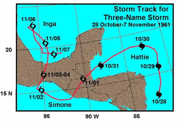
Hurricane Hattie formed in the Caribbean Sea off the east coast of Nicargua, then passed over Belize into Guatemala and the Pacific Ocean to become Hurricane Simone, then crossing through Mexico and arriving in the Gulf of Mexico near Veracruz, becoming Hurricane Inga. |
|
Destructive Features of Hurricane Hattie on St George's Caye
|
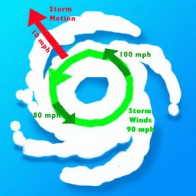
Why was St George's Caye impacted so severly by Hurricane Hattie even though she made landfall 30 miles away? As this illustration from NOAA shows, the NE quadrat of the hurricane is the worst, ie this area will experience strongest winds and destruction. |
|
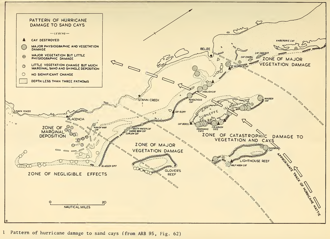
Dr Stoddart published the illustration "Pattern of Hurricane Damage to Sand Cays" in the Atoll Research Bulletin in 1963, which summarizes the extent of the damage to vegeation and sandy cayes. St. George's Caye lies within the "Zone of Catastropic Damage to Vegetation and Cayes" and the island is marked as "cay destroyed." |
|
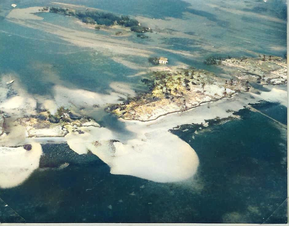
Photo courtesy John Charnock-Wilson. Colorized image prepared by Hector Andrews.
|
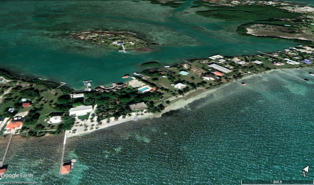
Google Earth Pro image of the same section of St George's Caye to show location of the channels made by Hurricane Hattie.
|
Images from Belize City
Links
Hattie. Charnock-Wilson accounts share by John Charnock-Wilson